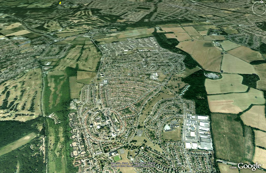
New Addington in 2014, with a multi-fold population expansion, plus the Fieldway Estate to the north.
Incidentally, the green-field area in the center of the bottom edge of the image - Milne Park Playing Field - is all that remains of a former airfield. In 1930 an application was made for the use of a field at Addington as a private aerodrome; Croydon Corporation objected on environmental grounds but was overruled by the Minister of Health. The Air Ministry sanctioned the use of a field in spring 1932, with the area laying between Featherbed Lane and Lodge Lane, and extended from St. Edwards Church to Fairchildes School at the southern end. The playing field is all that now remains of the aerodrome, the adjacent land having been developed for housing and local amenities. More. ©2026 Google Earth. All rights reserved.